🇩🇪 German storm chasers
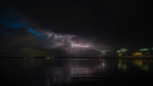
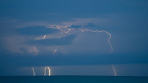
Lightning over the Chiemsee by David S. Bache
Awesome lightning strikes over the Chiemsee.
Thunderstorm over Altötting by David S. Bache
A strong thunderstorm over Altötting, Bavaria.
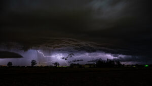
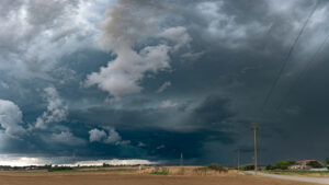
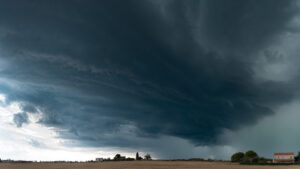
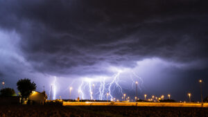
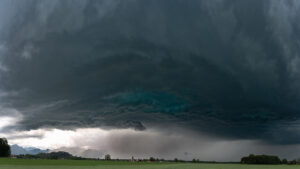
Huge supercell in Tittmoning by David S. Bache
It was very impressive. An unstable air mass with excellent shear and sufficient moisture was able to form this supercell.
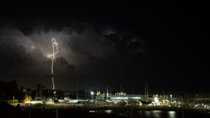
Bolt from the blue at the coast of Rome by Michi Hutter
As the supercell moved southward along the coast, multiple CGs brightened up the sky on the backside of this storm.
Frequent lightning at the coast of Livorno by Michi Hutter
After a calm night storms were firing up close to the coast of Tuscany.
Strobe lightning along the coast of Rome by Michi Hutter
Shortly after a powerful supercell hit the city of Civitavecchia, an impressive lightning show began.
Bluish supercell in the plains of Lazio by Michi Hutter
In the afternoon the very moist air mass at the coast of Lazio exploded and an isolated supercell formed near Orbetello.
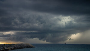
Wall cloud north of the Port of Rome by Michi Hutter
Very low wall cloud of a supercell north of Port of Civitavecchia, also known as Port of Rome.
Supercell over the Port of Rome by Michi Hutter
Powerful supercell over the Port of Rome, Lazio, Italy.
Powerful supercell near Tarquinia by Michi Hutter
The photo was taken just a few moments after a powerful supercell began to rapidly intensify.
LP supercell spinning across the Plains of Ferrara by Michi Hutter
This was the first storm during a high-shear setup with multiple supercells in Northern Italy.
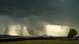
Downburst near Wolfhagen by Aaron Sperschneider
Downbursts are strong downdrafts that are often associated with intense heavy rain and hail. As soon as the downdraft reaches the ground, it spreads sideways, and the wind can reach hurricane force.
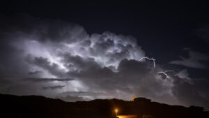
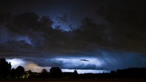
Epic night by Florian Sabo
Crazy lightning show in the Friuli Plains near Lignano, North Italy
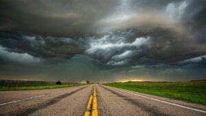
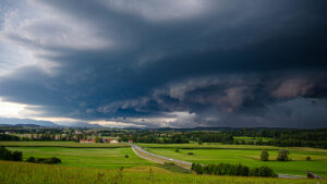
Massive squall line in Nebraska by Aaron Sperschneider
Nothing happened for a long time that day over rural Nebraska. Just some weak thunderstorms.

Photogenic LP supercell in Sangerhausen by Michi Hutter
In an environment with very good shear conditions some very photogenic LP supercells developed over Thuringia and Saxony, and we were able to intercept one of them at Sangerhausen in the southern Harz region.
Stormy summer night in Bavaria by Michi Hutter
Powerful cell south of Munich with nice structure, which was producing some great CGs and crawlers at this time.

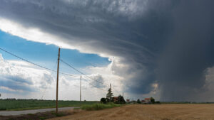
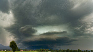
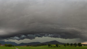
Impressive supercell west of Bad Tölz by Michi Hutter
Mesocyclone structure on an HP supercell west of Bad Tölz, as it was moving east close to the mountains. At this point the supercell reached its peak intensity with lots of close lightning strikes
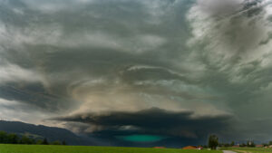
Insane structures of the supercell near Bad Tölz by Michi Hutter
Such an amazing experience after waiting for more than two hours in the Bavarian landscape. This storm managed to form these insane structures in only 15 minutes.
Line of severe storms in southern Bavaria by Michi Hutter
After becoming outflow-dominant, the HP supercell quickly changed into a severe line of storms, giving us still some good structure.
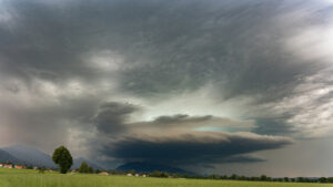
Powerful HP supercell in Bad Tölz by Michi Hutter
Ahead of a cluster of storms a powerful supercell developed in the Oberammergau area in the early afternoon.
A magical storm in Bavaria by Michi Hutter
The Bavarian edge of the Alps did its magic again.
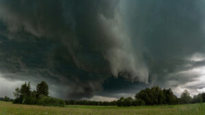
Massive wall cloud over the Bavarian Alps by Michi Hutter
A beautiful wall cloud came over the mountains of the Bavarian Alps with frequent lightning all around it.
Early stage of the HP supercell in southern Bavaria by Michi Hutter
An intense hail core rushed to my position near Rosenheim together with some close-up lightning strikes.
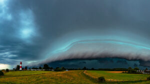
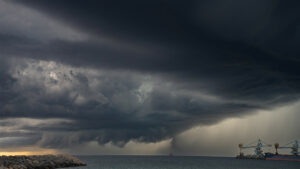
Impressive shelf cloud over North Germany by Marius Block
Shelf cloud over North Germany at the coast of the Baltic Sea near the lighthouse.